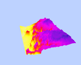
This data is taken from a location in Eastern Arizona. I chose it because of the interesting changes in elevation. There are drastic changes in elevation which I believe to be the edges of plateaus. This was a very interesting lab because I got to work on my own to create models, which I never thought possible. It's great that students like myself can just access this type of data to work with and manipulate for the purposes of learning!
Spatial Reference: GCS North American 1983-
Raster: ned_34737954
Datum: D_North_American_1983
Extent:
left: -112.26
right: -111.68
top: 35.17
bottom: 34.84
Digital Elevation Model with Hillshade

Slope

Aspect

3-D Model

No comments:
Post a Comment